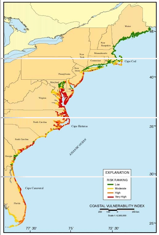
Through the use of a coastal vulnerability index, or CVI, the relative risk that physical changes will occur as sea level rises is quantified based on the following criteria: tidal range, wave height, coastal slope, shoreline change, geomorphology, and historical rate of relative sea level rise.
This approach combines a coastal system’s susceptibility to change with its natural ability to adapt to changing environmental conditions, and yields a relative measure of the system’s natural vulnerability to the effects of sea level rise. The USGS is now involved with the National Park Service applying the CVI to coastal park units.
– US Climate Resilience Toolkit
The hazard impact maps have already been generated for the user in this tool. The report provides visualizations and explanations of results. Additionally, the tool supplies the data used so the user may recreate the hazard impact maps.
